Getting started with QGIS:
Background, orientation, recommended Plug-ins
GIS: (Geographic Information System) An integrated collection of computer software and data used to view and manage information about geographic places, analyze spatial relationships, and model spatial processes. (from A to Z GIS)
Visit:
QGIS: (aka Quantum GIS) An open source GIS desktop application.
- Free and Open Source Software (FOSS)
- Full-featured GIS desktop application
- Runs on Windows, Mac, Linux, … and Android? Sure, why not!?
- Current version: Long-Term Release: 3.4.15; Latest Release: 3.10.2
- QGIS.org
- Show QGIS some love by buying a mug or t-shirt!
- Download QGIS
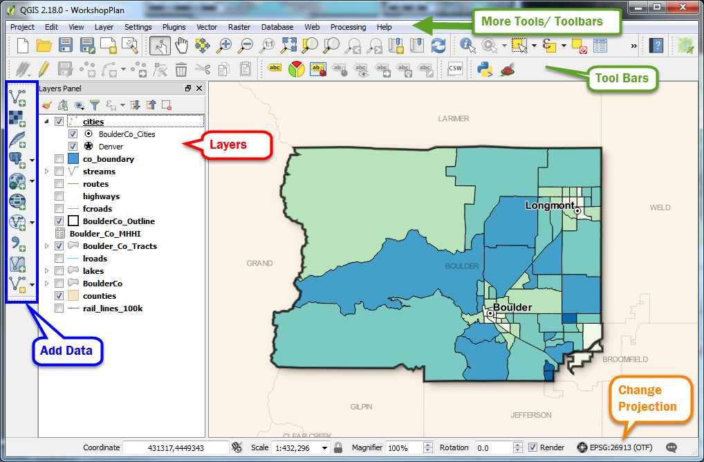
The QGIS Desktop Interface:

Interface Tips:
- The most frequently used toolbars/panels will be visible by default, but if you’re missing some of the toolbars or panels visible in the image, you can turn them on under View > Panels or View > Toolbars.
- Recommended Panels:
- Layers Panel
- Browser Panel
- Recommended Toolbars:
- Manage Layers toolbar
- Use the Hand icon as your default cursor to help you navigate.
- We highly recommend using a mouse (aids with navigation/zoom).
Plugins!
As an open source project, anyone can develop plugins to use with QGIS. Sometimes if a tool for a particular task isn’t available in the regular tools you can find it in Plugins.
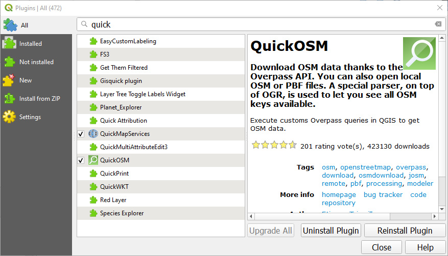
To add a plugin, click plugins> Manage and Install Plugins… 
You can search and install plugins, view your installed plugins, or install plugins you’ve downloaded elsewhere from the Plugins Repository. 
Recommended Plugins
- QuickMapServices: Easily load basemaps from 20+ providers (check out Stamen Watercolor)
- QuickOSM: Quickly extract vector data from OpenStreetMap’s massive repository.
Documentation
QGIS documentation has really improved in the past several years! View the User Manual, Training Manual (with lessons), and introductory guides.